HIGH TECHNOLOGY
Online on Everest
by Linnea Christiani
Vice President, MEI
 Over the last 3 years, my husband and I have spent our vacations trekking high in the Himalayas. In 2004, I slogged over 16,000-foot passes in Bhutan. In 2005, I hiked up to 17,000 feet to the base of Mount Kangchenjunga in Sikkim, and finally, in the spring of 2006, I climbed up to 21,000 feet to the Advanced Base Camp on the north side of Everest. Other than the fact that I found myself so far above sea level, what amazed me most in my travels was the extent to which technology had penetrated these remote places and changed wilderness travel, high-altitude trekking, and expeditions. Connecting with people and information from practically the top of the world gives you a deeper appreciation of the extent to which one can transcend time and space. The world feels a lot smaller when you can have an interactive e-mail exchange with someone in your family half a globe away and half a day behind or make a satellite phone call from an elevation that can barely sustain life. The global nature of the Internet becomes very real when you can find out what is happening pretty much anywhere in the world from pretty much anywhere in the world. Over the last 3 years, my husband and I have spent our vacations trekking high in the Himalayas. In 2004, I slogged over 16,000-foot passes in Bhutan. In 2005, I hiked up to 17,000 feet to the base of Mount Kangchenjunga in Sikkim, and finally, in the spring of 2006, I climbed up to 21,000 feet to the Advanced Base Camp on the north side of Everest. Other than the fact that I found myself so far above sea level, what amazed me most in my travels was the extent to which technology had penetrated these remote places and changed wilderness travel, high-altitude trekking, and expeditions. Connecting with people and information from practically the top of the world gives you a deeper appreciation of the extent to which one can transcend time and space. The world feels a lot smaller when you can have an interactive e-mail exchange with someone in your family half a globe away and half a day behind or make a satellite phone call from an elevation that can barely sustain life. The global nature of the Internet becomes very real when you can find out what is happening pretty much anywhere in the world from pretty much anywhere in the world.
Internet technologies were introduced into the Himalayas in the mid-1990s when the Web started its phenomenal growth in order to facilitate access to information and communication between communities. Nongovernmental organizations (NGOs), such as the International Centre for Integrated Mountain Development, and international organizations, such as The World Bank, supported this development along with regional governments. Despite the rough mountainous terrain and physical isolation of many of the villages, access spread rapidly once broadband wireless technology became available. In fact, the very remoteness of these villages and their fundamental need to communicate probably drove the growth. Now, satellite and wireless technologies provide vital infrastructure in places where the only means of transportation is walking and where telephone and postal services are nonexistent.
Background
My high-altitude adventures in the Himalayas began in 2004, after my husband Rick and I decided that if we were ever going to trek the Himalayas, now was the time to do it — after our children were grown and we could afford it, but before our joints gave out. We also wanted to go there while there were still safe regions in the Himalayas — and trekking in politically unstable areas such as Nepal and Pakistan had already become risky. Maoist rebels were routinely extorting money from trekkers and climbers in Nepal, and Al Qaeda was presumed to be holed up in the Hindu Kush region of Pakistan. We wanted adventures, but not ones that included being held up at gunpoint or sharing mountain scenery with Osama Bin Laden. So we looked for treks in other Himalayan countries. We had heard that Bhutan, a Buddhist kingdom sandwiched between India and China, was safe as well as beautiful and unspoiled. However, Bhutan only issued visas to tourists traveling in organized groups and collected a per-diem fee for each person. We had never traveled with a tour group or guide before, but we decided to give it a try once we learned that these policies were imposed to minimize the impact of tourism on the country’s environment and that Bhutan used the fees to restore its temples and train its craftspeople.
After researching various travel companies and comparing costs and itineraries online, we selected Canadian Himalayan Expeditions, Ltd. (C.H.E.) [http://www.himalayanexpeditions.com], a small-group, adventure, travel company with more than 20 years’ experience. We signed up for the 120-mile, Chomalhari-Laya-Gasa trek in Bhutan — the first of three treks we would take with C.H.E. Despite wet weather and only limited views of the awesome peaks in the clouds, it was a wonderful experience. We also discovered how much we liked having our gear carried on pack animals rather than on our own backs and what a treat it was to let someone else worry about the logistics! We also benefited from the expertise of our Bhutanese guides and our leader, Joe Pilaar, C.H.E.’s founder and director, as well as the use of communication technology. The following year, Joe invited us to try out a new C.H.E. trek in Sikkim, a former kingdom that is now the 22nd state of India. This gave us another opportunity to see the 8,000 meter peaks that we had missed on our first trek in Bhutan.
In 2006, Joe contacted us again (like a drug dealer who knows when he’s got someone hooked!) and invited us to join an expedition to the North Col of Mount Everest (on the Tibetan side) that he was organizing with his friend, Jamie McGuiness of Project Himalaya [http://www.project-himalaya.com]. Jamie normally leads a group to the Advanced Base Camp (ABC) and the North Col for Project Himalaya each year, but in 2006, he was guiding the Everest Peace Project to the summit. The Everest Peace Project [http://www.everestpeaceproject.org] was a team of climbers of different faiths and nationalities. Since the C.H.E. group would share Project Himalaya tents and support, it would make the trip more affordable and also offer us a glimpse of how summit teams trained and some of the challenges they faced.
Although I was interested in seeing Tibet and Everest and had enjoyed the previous treks, this one sounded out of my league. I envisioned kicking steps in snow at high altitudes with a full pack on my back, crampons on my feet, and an ice axe in my hand. Not an appealing picture! But then neither was the alternative prospect of waiting alone in Everest Base Camp for 10 days until everyone returned. Initially, my husband was just going to go with our son, but I decided to join them once I learned that the only technical climbing on the trip would be the section between ABC and the North Col, a 1-day ascent and descent which I could skip. The rest of the way, we would walk up a glacial moraine on a rocky trail with yaks to carry our gear to the camps. I just needed to make it up to 21,000 feet! Of course, I labored under the misimpression that I could return to a lower camp whenever I wanted, not fully appreciating the logistics involved. So I ended up going back to the Himalayas for the third year in a row and climbing higher than I had ever been in my life.
Bhutan
In 2004, it took 7 days by foot to trek to Laya, a 15,000-ft. village in Bhutan. It was harvest time and the villagers were out in the fields threshing wheat by hand with sickles, wearing the native dress and pointed straw hats of the Layap people. The village had no wheeled vehicles; everything was carried on animals or in baskets. However, unlike similar villages we had encountered years earlier in Peru, Laya’s residents had solar-powered electricity. The King of Bhutan had sent solar panels to many remote villages to provide a source of renewable energy, effectively skipping over several generations of technology. The village also had a computer in its school with access to e-mail and the Internet. In fact, when we showed a group of villagers the digital photos we had taken of them on the camera viewer, they gave us e-mail addresses so that we could send copies back. My husband’s uncle, Ralph Britton, who traveled with us to both Bhutan and Sikkim, sent photos back to the village teacher and remained in e-mail contact with him. Later he learned that someone had dropped the school’s computer and it no longer worked. So when we returned to Sikkim the next year, he brought a laptop with him to donate to the school, and the teacher made arrangements to have it picked up and taken back to Laya.
We also discovered that we could communicate with friends and relatives at home via e-mail at Internet shops and cyber cafes in Paro and Thimphu, Bhutan’s major cities. Of course, we had to wait our turn behind the young patrons sending messages to friends and playing online games. The response time was also very slow and the keyboard somewhat different, so it could take 20 minutes just to send one message. However, it was a lot faster than mailing postcards that would arrive long after we returned.
Sikkim
The following year in Sikkim, India, keyboards and communication speed were fine as long as the equipment worked and the power stayed on. The biggest obstacles in Sikkim were the scarcity of equipment and loss of electricity from overloaded circuits or bad weather. On that trip, however, Internet access provided us more than just a convenient way to connect with friends and relatives at home. It also allowed us to communicate with the U.S. Embassy from a very remote and rugged part of the world, which ended up saving the trip for us.
Sikkim is located on the eastern end of the Himalayas in a restricted part of India where foreigners must obtain a special permit to visit. After we arrived by helicopter at Gangtok, the one major town in the area, my husband went through security and discovered that his passport was missing. He was allowed to stay because he was part of a group and C.H.E. had obtained a permit for him in advance. However, he knew that he would need the real thing to get back into the U.S. and that there would be no time to do so on our return to Delhi before flying home. It was Sunday when we arrived in Gangtok and we were leaving early Tuesday morning to drive to Yuksum. That left Monday to contact the embassy. It turned out, however, that it was Buddha’s birthday on Monday and everything, including the American Embassy, was closed. (It’s always something!) Our only hope was to somehow contact the embassy from Yuksum, the last point open to travelers in western Sikkim and at the base of our 10-day trek. Otherwise, we would have to cut the trek short and return to Delhi early.
To get to Yuksum, we drove all day over impossibly steep, narrow, and sometimes washed out roads. Just before we arrived in the village, our driver stopped to pick up a young woman who was walking up the road in the rain with a piece of electronic equipment in her hands. It turned out that she owned the only Internet shop in town and had borrowed a modem from the local school to replace one that had crashed earlier that day — the good news and the bad news! Once she learned of our plight, she took us back to the school where we were surprised to find about 10 students online. They loaned one of the computers to me and I found the embassy Web site and contact information, reported the passport missing, and gave them C.H.E.’s satellite phone number via e-mail. The next morning, a call came in on the satellite phone informing us that Rick’s passport had been found and would be waiting for him when he returned to Delhi. Considering the remoteness of our location, we considered this a minor miracle and gave thanks to Buddha for Web and satellite phone technology.
We could only imagine how important Internet access has become to the students and other residents living in this isolated and primitive area. In a relatively short period of time, it must have dramatically changed their knowledge of the outside world as well as the quality of education and life in the region. In addition to e-mail communication and Web access, Internet technologies could offer them distance learning and video conferencing where there are few teachers, inexpensive voice communications where there is no telephone or postal services, e-commerce capabilities where there are few shops, and communication with specialists where there are few doctors or medical services.
Kathmandu
After our experiences in Bhutan and Sikkim, I expected to have access to e-mail on our 2006 trek in the Himalayas, so before leaving, I created lists on Yahoo! of e-mail addresses for friends and colleagues who wanted to get updates during our travel. I also checked the Centers for Disease Control and Prevention (CDC) Web site [http://www.cdc.gov/travel] for health warnings about avian flu, SARS, or malaria in the areas where we would travel, and the State Department Web site [http://travel.state.gov] for travel warnings. Our travel plans had us in Kathmandu for 2 nights on our way in and out of Tibet and, at that time, civil unrest was on the rise after King Gyanendra disbanded the Nepalese Parliament and instituted martial law [http://en.wikipedia.org/wiki/2006_Democracy_movement_in_Nepal]. I found no health warnings in the Himalayan regions, but I did find a disturbing travel warning on the State Department site. It urged American citizens to defer all non-essential travel to Nepal while urging any Americans already in Nepal to consider leaving. It also gave permission for all non-emergency State Department employees to depart. Although my husband considered an expedition on Everest as “essential travel,” I had my doubts. On the other hand, I was also in e-mail communication with people at C.H.E. who were in e-mail communication with people on the ground in Kathmandu. They assured us that tourists were still safe and that we should be able to get in and out without problems.
Nevertheless, as our departure approached, the situation worsened, and reports of strikes, violence, and food shortages in Kathmandu began appearing in U.S. newspapers. On the morning that we were scheduled to fly into Kathmandu from Bangkok, we heard on CNN that an 8-hour curfew would be in effect when we landed at the airport. As we flew into the city, we could see flags, demonstrators, and smoke and wondered what we would encounter on the ground. A hotel shuttle was supposed to pick us up, but how would it get to us if no vehicles were allowed on the street? There were four of us traveling together, Bruce Fessenden (a friend who has done many climbing and skiing trips with us, including the Andes expedition), our son Eric, Rick, and me, with a lot of luggage among us: four daypacks, six large duffle bags, and two large backpacks that held our climbing and camping gear as well as travel-, trekking-, and expedition-level clothing. After we cleared customs, we were relieved to find Joe waiting for us. Luckily, the government provided buses to take travelers to their hotels, and Joe had come to shepherd us to the right one. Everyone rushed aboard the bus when it arrived, and we struggled to get all our gear, not to mention ourselves, onto the bus before it filled up. We could only imagine how chaotic it would be if we had to evacuate the city quickly.
The bus dropped us off in the Thamel district a few blocks from the Kathmandu Guest House, and Joe went for porters. As we followed them back to the hotel, we passed shops with doors rolled down and armed guards patrolling the streets. The next day, an estimated 300,000 to 500,000 people took part in protests in Kathmandu and the curfew was reinstated. Even though tourists weren’t officially required to observe the curfew, security forces had “shoot to kill” orders for violators, making it risky to be on the streets. Under the circumstances, we considered ourselves virtually under house arrest at the hotel during curfew.
Mobile phone and Internet services were also cut off during curfews and, in between, the Internet shops were very full. Fortunately, the Kathmandu Guest House had its own direct satellite uplink so I could pick up e-mail and search the Web from the computer room during the curfews. Oddly enough, one of my best sources of information about the situation in Kathmandu was Barbara Quint, who would send me links to the latest reports on NYTimes.com. Here I was at ground zero but getting information about the situation outside the hotel gates from another continent! Luckily, the curfew was lifted for a few hours the next morning, so we sped to the airport for our flight to Tibet. However, I still worried about our return trip, which would have us driving back to Nepal through rebel-held territory and into an area that the State Department had advised Americans to avoid.
Lhasa
In Tibet, we faced other challenges. During the first week, we would sightsee and acclimatize at increasingly higher altitudes as we journeyed from Lhasa, at 12,000 feet, to Rongbuk, at 16,000 feet, just below Everest Base Camp. Lhasa, Tibet’s capital, is a contrast of ancient Buddhist monasteries and palaces juxtaposed against the oversized boulevards, plazas, and modern buildings built by the Chinese after its invasion in the 1950s. Buddhist monks, pilgrims, and other ethnic Tibetans share the city with large numbers of Chinese immigrants and tourists. However, there are concerns that an additional influx of Chinese might overwhelm the Tibetan culture altogether with the installation in June 2006 of a new high-speed train from China to facilitate tourism and relocation. On the other hand, the growing interest of the Chinese in Tibetan Buddhism has influenced China to preserve Tibet’s surviving monasteries as tourist attractions.
In visiting them, we were struck by how little the monasteries have changed physically since the 15th century and how any use of modern technology within those settings seems like an anachronism. Nevertheless, the prime minister of Tibet’s government-in-exile believes that there is something inherently Tibetan about the Internet because, in Buddhist philosophy, everything in the universe links to everything else and life is considered a network. Indeed, the monks are comfortable integrating technology into their otherwise simple lifestyles and use e-mail and cell phones to communicate with each other.
At the Sera monastery, for example, we observed monks debating the scriptures as they have done for centuries, physically hurling questions at each other like archers by raising a knee and pulling back an arm, and then shooting the arm forward with a question. As we watched this spectacle, we saw one monk stop midway in his delivery to pull a ringing cell phone out of his robe and answer a call (a religious call, no doubt). We were also amused to see that monks at the Drepung Monastery heated their teapots with solar panels. Like Bhutan’s monarchy, the Chinese government has invested in solar technology in this region, and solar panels are visible on even the most primitive yak herder tents. Cell phones and computers are also ubiquitous in Lhasa. The Chinese-owned hotel where we stayed even provided a computer with Internet access in the lobby for its guests. This allowed me to send out e-mail messages to let friends and family know that we had arrived safely.
Everest
In the increasingly remote areas where we traveled after leaving Lhasa, it became difficult to communicate by e-mail; the hotels no longer provided Internet access or even phone service. There were Internet shops in the towns where we stopped for the night, but they were neither easy to find nor convenient to use. Since the northern Chinese/Tibetan side of Everest was closed to outsiders for many years and has only recently begun to attract a large number of expeditions due to the political instability in Nepal, the area has been slower to develop tourist services than the southern Nepalese side. Nepal, on the other hand, has catered to the needs of expeditions and trekking tourists for years and, as a result, has been a leader in Internet connectivity and development as well. For example, in 2003, a cybercafe supported by wireless links was opened at the 18,000-ft. Everest Base Camp (EBC) on the southern Nepalese side; in 2006, new lodges with Internet access opened in nearby towns. The Tibetan side may undergo similar development in the future as it competes with Nepal for expeditions.
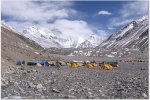
Nevertheless, when we finally arrived at the 17,000-ft. EBC on the northern (Tibetan) side, a rocky plain covered with the tents of expeditions from all over the world, I was pleased to discover a computer in the Project Himalaya dining tent. It was hooked up to a satellite modem and charged by solar panels outside the tent. The expedition leaders used it to dispatch commentary and photos, including video clips, of daily activities for uploading to their Web site. They also used the computer to pick up customized weather reports e-mailed to the expedition each day by a subscription service. Although free weather reports for Everest were available on the Adventure Weather site [http://www.adventureweather.com], the cost of satellite communication restricted use of the modem to sending and receiving messages once a day — no Web surfing. Consequently, although I could use the Project Himalaya e-mail account to send out a message that we had arrived safely at Everest, it only went to the e-mail addresses that I could remember because I couldn’t access my lists on Yahoo!.
After 2 days at EBC, we started our ascent to Advanced Base Camp (ABC). For the next 4 days, we made our way up to Camp 1, Interim Camp, Camp 2, and finally ABC, spending 2 nights at Interim Camp to help with the acclimatization process. We traveled up a rocky trail alongside a frozen sea of seracs formed by the Rongbuk Glacier. Yaks transported our gear, and we minimized weight in our daypacks by only carrying what we needed on the trail, such as water, a fleece shell, and rain gear. Luckily, the storms that hit Tibet the previous week had passed, and, for the most part, we had clear, warm days. However, we would still get local snow showers in the late afternoon and evenings.
On the first day out, this was a problem for the fastest hikers in the group because our yak train was slow to arrive and these folks shivered for several hours until the tents were set up. Our son, Eric, was among that speedy group. At least he was until the last stretch up to ABC. To our surprise, around 20,000 feet we caught up to him sitting on a rock somewhere between Camp 2 and ABC. I stopped to take a break with him while Rick continued on. However, once we started walking again, I discovered that Eric was stopping every hundred feet or so to catch his breath. He had started the trip with some congestion in his chest, and, apparently, it was getting worse the higher he went. I stayed with him as he very slowly made his way toward camp, encouraging him to get up and keep going whenever he rested too long.
On the first day, we waited for the tents, warmer clothing, sleeping bags, and the food we needed for survival to arrive. Now these necessities were in camp ahead of us and we needed to reach them even though it meant going higher. I was getting increasingly concerned about what I would do if Eric could not continue or collapsed, since I could not carry him. Although I knew there was a guide at the end of our group who could radio ABC for help if we needed it, it had begun to snow and I wanted to get to shelter before dark. Nighttime temperatures at that altitude can drop 20 below or colder. Luckily, Eric has a high pain threshold and great endurance from years of competitive rowing and mountaineering, so he kept moving, one step at a time. Finally, we spotted ABC, a virtual sea of tents spread a long way up the mountainside sporting the names of the same teams we had seen at EBC. Neither of us had much energy left by then, so we were happy to find the Project Himalaya dining tent near the lower end of camp, a big orange and gray Mountain Hardwear tent that would be our central gathering place and command center for the next 3 days. Outside the tent was a tall antenna and solar panels, and inside, a large table, plastic chairs, a small heater, a noisy VHF radio transceiver, oxygen cylinders, and a computer.
Jamie McGuiness was there, too, when we stumbled in the door. He took one look at Eric’s nearly blue face and immediately put a pulse oximeter on his finger to measure his pulse and oxygen saturation levels. We had checked our levels earlier in the trip and Eric’s had been close to 80 percent. Now, at 21,000 ft., his pulse was 120 and his oxygen saturation 43 percent — little more than half the oxygen he was breathing at the lower camps! At sea-level, oxygen saturation is typically 99 percent to 100 percent, so this was dangerously low. In general, our group ranged from 65 percent to 85 percent depending on how long each person had been at altitude and how quickly they adapted to it. Mine was averaging around 68 percent, a level at which I would be hospitalized at home, but not unusual on Everest.
Jamie and Joe both said that Eric would need to go down as soon as possible or he could risk dying from high altitude pulmonary edema (HAPE), a life-threatening condition more prevalent in stronger climbers who ascend too rapidly. Fortunately, the Everest Peace Project had oxygen stored at ABC for their summit attempt and Jamie put Eric on oxygen that night. Otherwise, he would have had to make the long descent to EBC in the dark while already exhausted, covering a distance that had taken us 4 days to reach.
The next morning, Eric’s oxygen saturation level had not improved despite being on supplementary oxygen all night, so plans were made to send him down to EBC with two Sherpas and a hand-held radio. Logistics are always an issue on the mountain, but since his sleeping bag and other gear were in a large backpack, one Sherpa carried it while the other carried his daypack and Eric carried an oxygen cylinder. I wanted to accompany him, but my gear was in a large North Face duffel bag and a yak could not be spared just to haul my bag, nor was it really critical that I go down with him. Eric also wanted to make it to EBC before dark. Even with the oxygen on his back, he could move faster than me downhill and he told me, “I’d love to have you with me, Mom, but you’d slow me down.” Needless to say, I was very worried and extremely thankful that we could keep in radio contact.
In the meantime, I used C.H.E.’s satellite phone to call my daughter, Ashley, who is a physician, and apprise her of the situation. She was very concerned when she heard the news and worried that the 17,000-ft. base camp might not be low enough if Eric had pulmonary edema. Fortunately, it was, and he recovered quickly at the lower altitude. Once we had confirmed with the guides at EBC that he was fine, I sent Ashley an e-mail message from the computer in the dining tent. However, I later learned that she never received it. It went out under Jamie’s e-mail address, so she may not have recognized it as coming from me and left it unread. (Spam adds another crime to its list.) On the other hand, something may have blocked the satellite transmission or maybe I typed her e-mail address incorrectly. After all, my oxygen saturation levels were low, too, and I didn’t have access to my e-mail lists. I just assumed she received it, but did not get confirmation, because I couldn’t get e-mail back; nor did I call her on the satellite phone again because of the cost (several dollars a minute). That we could communicate with the world was a minor miracle considering the fact that we were halfway up the highest peak on the globe, but access certainly wasn’t free or even entirely reliable.
Back to Kathmandu
I had planned to let family and friends know once we had safely descended and returned to EBC, but I was so exhausted after the 9-hour, 4,000-foot descent from ABC to EBC that I only had enough energy to eat and crawl into my sleeping bag that night. The hotel in the small border town where we arrived the next night had no Internet connectivity or even showers. However, the town did have Internet shops and a Japanese-style bathhouse. Given the choice of using my time before dinner to send out messages from a dingy Internet shop or to soak my sore muscles in a hot bath and wash my hair after 2 weeks of sponge baths in a tent, I rationalized that everyone could wait another day until I got back to the Kathmandu Guest House. In the meantime, however, my daughter had been waiting 5 days to hear back from me, and she and other family members were becoming extremely worried. They assumed that something must be terribly wrong, when, in fact, it was just a communication error compounded by the difficulty of maintaining contact in remote areas, even with advanced technology. Finally, one of my sisters contacted C.H.E.’s agent in Kathmandu, who managed to reach us on the satellite phone while we were in transit to Nepal. We reassured everyone that we were all fine, but felt badly that they had worried unnecessarily. In retrospect, I probably should have waited to contact my daughter until after I knew the outcome since there was nothing she could do from that distance except worry. Getting news as it happens creates a sense of immediacy and, in this case, set up an unrealistic expectation that the communication would continue.
For the most part, however, today’s communications tools have made climbers safer and provided desired access to their families. The same technology has also enriched the lives of people living in high, remote regions by connecting them with the wider world and has in turn provided the wider world access to information about these regions. Without the availability of online news from Nepal, we would not have known that the king reinstated Nepal’s parliament on April 24 while we were in Lhasa; or that the strikes and curfews had ended, telecommunications were restored, and life in Kathmandu was returning to normal while we were on Everest [http://www.kantipuronline.com/ktmpostarc.php?id=3&pubdates=2006-4-25]. Nor would we have known that the Maoists announced a 3-month truce on April 27 and that our route back to Nepal was much less dangerous. Since Nepal was such an early adopter of the Internet and access was so widespread, I could only wonder at the role it must have played in spreading the democracy movement and in coordinating demonstrations and strikes. The government obviously thought it significant, since it suspended mobile phone, instant messaging, and e-mail services during curfews. Nevertheless, there were too many direct satellite uplinks in Nepal to suppress access altogether.
When we got back to Kathmandu, it seemed like a different world and we had a good time visiting the many shops and restaurants that we had missed on our arrival. We especially enjoyed our last night in town on May 12, when we celebrated the success of the Nepalese people, a great trip, and Eric’s birthday.
Again and Again
I can hear you asking, dear readers, “With all that happened — would you do it again?” I guess the answer must be “Yes,” because my husband and I are already planning another mountain trek. However, I’ve told him that after going to the Himalayas 3 years in a row, I’d like to go somewhere lower, safer, and warmer on our next trip — somewhere with delicious food and comfortable beds, where I won’t have to wear an expedition down jacket to dinner, eat yak meat, or negotiate a slippery trail in the middle of the night to get to the bathroom tent. I’d also like to go somewhere that I don’t have to worry about getting sick from altitude, bacteria, mosquitoes, or chickens or getting blown up by terrorists, rebel insurgents, or government troops. I must be getting soft in my old age because I’ve found myself thinking more and more about treks from parador to parador in Spain, from ryokan to ryokan in Japan, or from lodge to lodge in Patagonia.
Most likely, however, the phone will ring soon and it will be Joe the Pusher from the Canadian Himalaya Expeditions, dangling another temptation in front of us and we’ll head back to the Himalayas for another high-altitude adventure!
|
Controversy on Everest
Shortly after we returned to the U.S., a media frenzy erupted over the death of British climber, David Sharp, and the survival of Australian climber, Lincoln Hall, on the north side of Everest. The controversy surrounding these events was sparked by an interview on May 23, 2006, with Mark Inglis, a double-amputee climber from New Zealand. Inglis reported that as many as 40 climbers passed Sharp on May 15, 2006, without offering him help as he lay dying at 28,000 feet. Then, 3 days later, on May 26, 2006, Lincoln Hall was found alive by a party of four climbers after being left on the mountain the previous night with cerebral edema (HACE) and declared dead by his team. These stories gave the impression that climbers were just being left to die on the mountain by other climbers intent on reaching the summit. Needless to say, it set off a flurry of worldwide condemnation, including criticism from Sir Edmund Hillary.
The stories disturbed me, too, since I had just been among these climbers at EBC and ABC and my son might have needed rescuing if he hadn’t made it into camp on his own. I knew from talking to the some of the climbers on summit teams that they invest an enormous amount of time, energy, and money into the effort. So, reading the stories, I found it conceivable that some climbers might have been too goal-oriented to stop. On the other hand, I found it even more conceivable, given my own experience with high altitudes, that they might have been too exhausted to help or too hypoxic to make rational decisions. As Jamie noted in a National Geographic Adventure article, “If you’re in a car crash in the U.K. and your blood-oxygen saturation level goes below 90 percent, the doctor is legally allowed to make decisions for you. At Advance Base Camp on Everest, at only 21,200 ft. (6,462 meters), the best we’ve ever consistently tested is 82 percent.”
However, I found it very hard to accept that the guides and Sherpas would just leave someone to die on the mountain so their clients could succeed. It certainly didn’t jibe with our experience on Everest. We had observed many acts of compassion and selflessness, even to strangers, and were recipients of help ourselves. There was no hesitation to share oxygen with Eric, even though climbers going to the top might have needed it. Likewise, two Sherpas went all the way down to EBC with him and back up again — a long, tough hike in both directions. Jamie McGuiness also came down with our group from ABC to EBC to assure that we all made it down before dark. The next day, he left to help rescue climbers from another expedition.
To find out what actually happened, I went onto the expedition Web sites for the viewpoints of those closest to the action. In both cases, it seemed clear that the climbers were left on the mountain because it was too difficult to bring them down. Jamie reported, “Dawa from Arun Treks also gave oxygen to David and tried to help him move, repeatedly, for perhaps an hour. But he could not get David to stand alone or even stand resting on his shoulders, and, crying, Dawa had to leave him too. Even with two Sherpas, it was not going to be possible to get David down the tricky sections below.” After he returned from Everest, Mark Ingles revised his statement that his team was told to leave David behind by their leader when they radioed him. Mark said the cold, strain, and lack of oxygen might have caused him to mix up the details.
In an ABC radio interview broadcast in Australia [http://www.abc.net.au/am/content/2006/s1649880.htm], Jamie described a similar situation with Lincoln Hall. According to reports, Sherpas from Lincoln’s team attempted a rescue for hours; but, as night began to fall, with their oxygen supplies exhausted and suffering from snow blindness, they were ordered by their expedition leader to leave an apparently dead Hall on the mountain and return to camp. Once Hall was found alive and able to move the next day, a summit team abandoned their attempt and stayed with him until he could get help from his own team. Apparently, it took 15 Sherpas and 50 cylinders of oxygen to get him down, which would not have been possible without help from other teams on the mountain, including Project Himalaya.
The Project Himalaya and Everest Peace Project Web sites also revealed that 10 members of Jamie’s team had reached the summit on May 18, 5 days after we left Nepal. However, the dispatch announcing the news was held up for 12 hours until the Everest Peace Project team made sure that two of its climbers were going to make it down. They also waited 10 days before posting a description of the rescue of South African team member Selebelo Selamolela. Everest Peace Project leader Lance Trumbull noted that “my main reason for not saying anything immediately was that I was concerned about Sele’s friends and family and did not want to say anything until I knew what was really happening. I also did not want to create media chaos where there did not need to be any” [http://www.mounteverest.net/news.php?id=10123].
Clearly, radio communication on the mountain was essential to the success of Sele’s rescue as well as Lincoln Hall’s. On the other hand, the Everest Peace Project was wise to wait before communicating the situation on its Web site. There was nothing that people on the outside could do while the rescue was underway except worry. In the case of Lincoln Hall, this constraint was not observed, and his wife was called and told that he was dead, only to be called back the next day by the “dead” man himself. As I learned from my own experience, communicating events in real time can lead to unnecessary concern and the circulation of misinformation.
Just because one can communicate, there are still times when Las Vegas rules should apply: What happens in the mountains stays in the mountains. It is very hard for outsiders to understand the full reality and circumstances of dealing with a crisis at high altitudes, even when they are experiencing the expedition virtually. The people making decisions and having to carry out rescues often must do so with oxygen-starved brains and/or while physically exhausted. Rescues involve complex logistics, limited resources, and difficult weather conditions, not to mention the ordeal of getting a compromised climber down over terrain that even strong climbers find hard to negotiate. Deciding who can be saved and when to give up on someone to save others is a little like triage in an emergency room. Sharp’s mother appeared to understand this and told reporters that David was responsible for his own survival and she did not blame the other climbers.
In reporting events in the mountains, the media often fails to understand the difficulties inherent in these harsh environments or that even guided clients climb at their own risk. Instead, the media quickly looks for blame when tragedies occur. The speed of recriminations is heightened by instant global communications and the ability of anyone to post an opinion on the Web to a broad audience. In the past, no one on the outside knew what happened during an expedition until afterwards and then the story was generally communicated by a spokesperson for the team. Of course, this also made misrepresentations and cover-ups a lot easier and few climbers would choose to give up the advantages of today’s technology. Most want to have direct communication with their families and to share their experiences with others online.
In maintaining expedition Web sites, however, leaders face communication issues similar to those that we experienced on Everest except on a larger scale. In this era of reality TV, real-time information and live news, people expect to be able to track an expedition’s progress. Thus, there is pressure on leaders to keep the outside world informed of events as the events unfold. To meet this expectation, Web sites are updated daily with video footage, photos, and commentary, a challenging responsibility for people already operating under difficult circumstances. However, when tragedies or rescues occur, leaders also face issues about how much information to share, when to make it available, and how to explain decisions made under adverse conditions.
The media needs to communicate information responsibly, too, and not assume that a single account or initial reports are always accurate. They should keep in mind that in reconstructing events, there is a psychological need for climbers to view their own actions in a favorable light and to blame others if mistakes have been made. Reality is also filtered through each individual’s experience on the mountain, which can often result in as many stories and opinions about what has occurred as there are climbers. After my own limited experience on Everest, I would hesitate to pass judgment on the decisions or actions of any climber without knowing the full circumstances. The convergence of factors — from the effect of altitude on climbers, the weather, the terrain, fatigue, and logistics — all interact and influence actions taken or not taken. |